Mexico Trip Report '06/'07Our most recent trip to research for "The River Gypsies' Guide to North America" took us south of the border to Mexico. We decided at the last possible minute that a trip down there was needed, since Mexico is a North American paddling destination with plenty of whitewater. We decided to explore the Eastern Slope - the Sierra Madre Oriental - in the states of San Luis Potosi and Veracruz. Here's the report: Santa Maria
Challenge#1: After hours of adventure on the Mexican backroads and about 20 stops to ask for directions that we didn't fully understand, we finally located the takeout. The first signs you see leading to Cascada Tamul along the highway from Valles go to the bottom of the falls, not the top. Because we were unsure of whether we could paddle through the Tamul Waterfall to continue downstream, we planned to carry up the ladders to the top of the falls and hike out from there. The road to the takeout was fairly rough and dirt, going on for about 11 miles. It became clear that if it rained while we were on the Santa Maria the next day (it looked like it might), we would need to have the 4x4 at the takeout or we might have to wait for days while the road dried out so that we could get Ben and Emski's Mexican rental car (and ourselves) out of there.
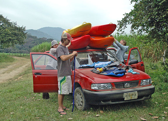
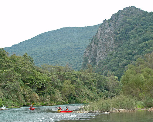
Up bright and early the next day, it's time for challenge #3: finding the put-in. We were rolling by 8 am, little car fully weighted down, trying to make time on the 11 miles back out to the pavement. Then it was 5.5 easy highway miles before we hit the dirt again, this time for 20+ miles (more like 30+ since we got lost so many times) to the river. We finally put in at 12:10 pm for a run that we had been told took 6 hours. We had about 5 hours of light left. That's not favorable math. Happy to be on the river, we were immediately wowed by the scenery as we approached the first gorge.
The first gorge had some light class III - mostly from water funneled into constrictions in the bedrock walls, with one spot which would have been class IV with more water (rolled boulder pile), but required a portage over some sieves and logs at the low level at which we found ourselves in there. After a few miles of beautiful gorge, the valley opens up and the river becomes FLAT for 7 miles - challenge #4. I'm not talking moving water or riffles (maybe 3-4 riffles the whole way) - I mean serious molasses. It was very pretty, but it was a long hard paddle to try and make time to beat the darkness.
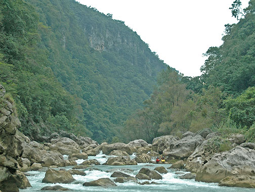
Challenge #5: The whitewater. The final gorge is a class IV gorge - somewhat sieve filled - that begins with a class V drop. The class V triple drop was too low to run, so we started with a carry. I managed a seal launch between two sieves to run the bottom drop, which turned out to not be worth the sketchyness of that move. Below here, there were some quality rolled-boulder style drops, interspersed with places where the river would totally disappear under boulder piles, necessitating portages.
Halfway down the final gorge, the riverbed changed back to bedrock class III constrictions like the upper gorge, allowing us to make more time as the day got closer and closer to an end. We finally rounded a bend and were rewarded with the view we came for - Cascada de Tamul. We stopped for a quick photo session of this incredible place.
Finally, with darkness fast approaching, we began searching for the trail to the ladders which would lead us out of there. After thrashing in the jungle brush some, we found the ladders that would take us to the rim and the trail back to our waiting truck.
Our race against time was a losing battle, and we ended up hauling the boats the last 100+ feet in the dark, and then hiking out by moonlight. Exhausted and starved, we quickly piled into the truck for the 2.5 hour ride back to the put-in. Next step - make our way to Veracruz, find and run the Alseseca. |






Featured Products:

The River Gypsies Guide to North America
$44.95

Yoga for Shoulders DVD
$24.95

North Carolina
Rivers & Creeks
$29.95